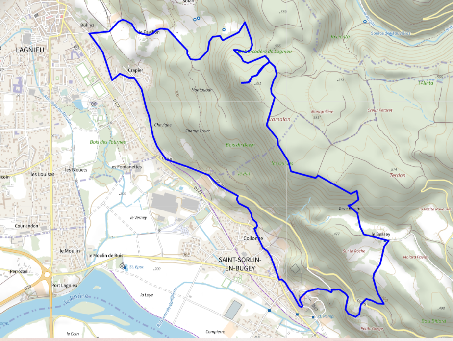
Distance : 10.1 km
Duration : 3h
Level : quite difficult
Elevation : 432 D +
Walking
Loop of Bramafan via Saint Sorlin
Distance : 10.1 km
Duration : 3h
Level : quite difficult
Elevation : 432 D +
Walking
Departure: Lagnieu
Loop
Stones, Earth, Hard surface (tar, cement, floor), Not suitable for pushchairs
Pet Friendly
The 600m to be done along the D60b to join the greenway
Departure rue de Bramafan, in Lagnieu, at the corner with rue de Bulliez.
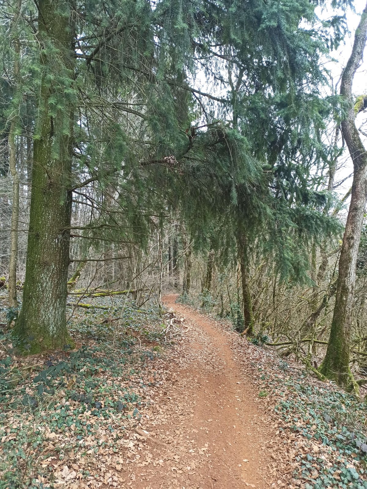
At the level of the castle of Bulliez (very beautiful private residence), the sign indicates the Bramafan 1h15 on foot (exact time for average walking speed. The path climbs continuously up to the Bramafan or almost.)
Follow the street to the end.
We pass the Pavilion: the beautiful private residence to which we must take the stony path to the left of the gate to continue the walk.
Straight up to the fork in the woods.
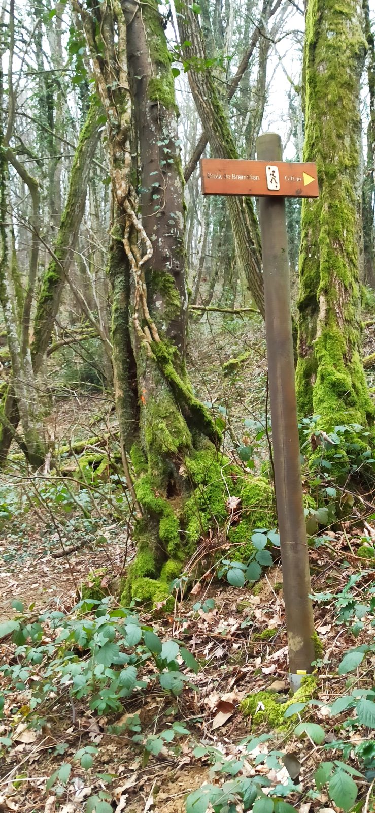
At the fork of the Pavilion (totem mark), turn left towards Bramafan (follow the small sign - X Leave direction St Sorlin on the right)
Follow the yellow markings to the "Pressandre" totem
At "Pressandre" turn right as indicated.
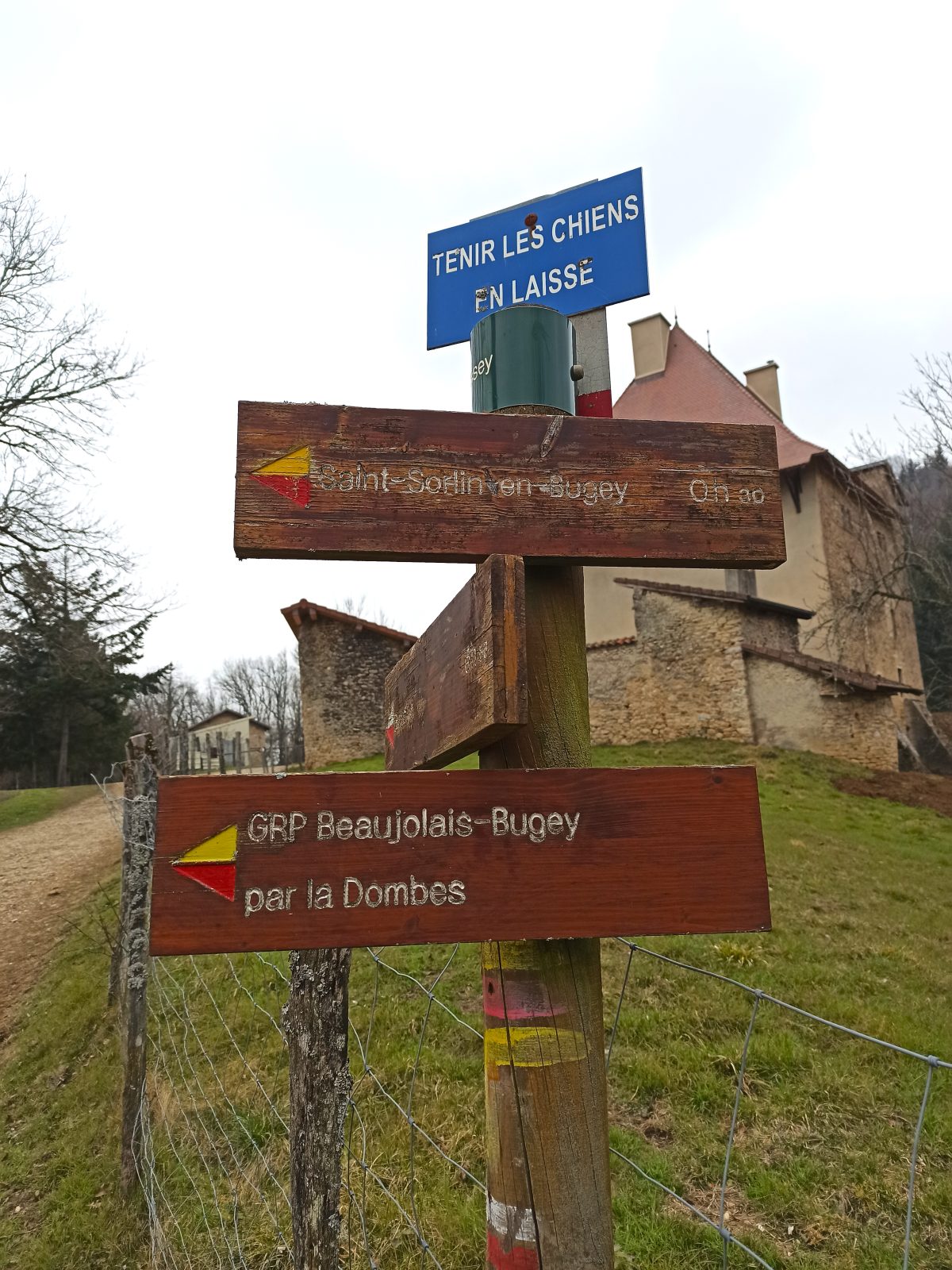
From there the markup is red and white (GR®59) direction Bramafan 1km and St Sorlin Bessey 3.5km
At the "Embarcade" totem two choices:
1/ turn right according to the indication "Croix de Bramafan" (10 min)
Raidillon a little slippery depending on the season (optional option, access to the panorama and orientation table)
Then go back down to the pier totem and continue
2/Follow the markings without going up to the panorama
At the pier totem follow the white and red markings, always in the direction of Bessey
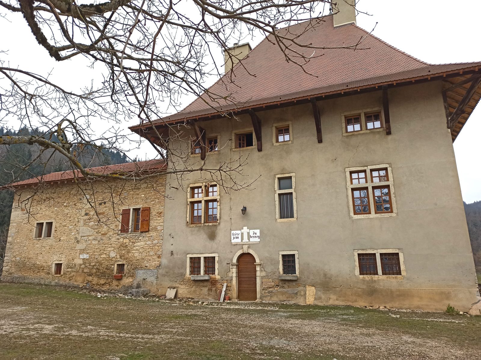
Once you have arrived at the Bessey farm (very beautiful private Renaissance farm), the markings turn yellow and red (FF de pays GR® de pays Beaujolais Bugey par la Dombes), descend to the right by the small path.
Once you get to the road, be careful when crossing it to take the opposite road.
At the next totem turn right towards St Sorlin 1km.
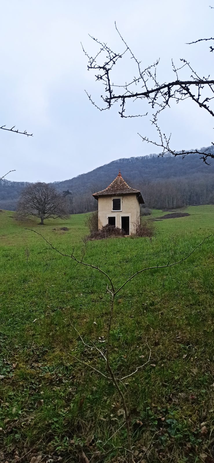
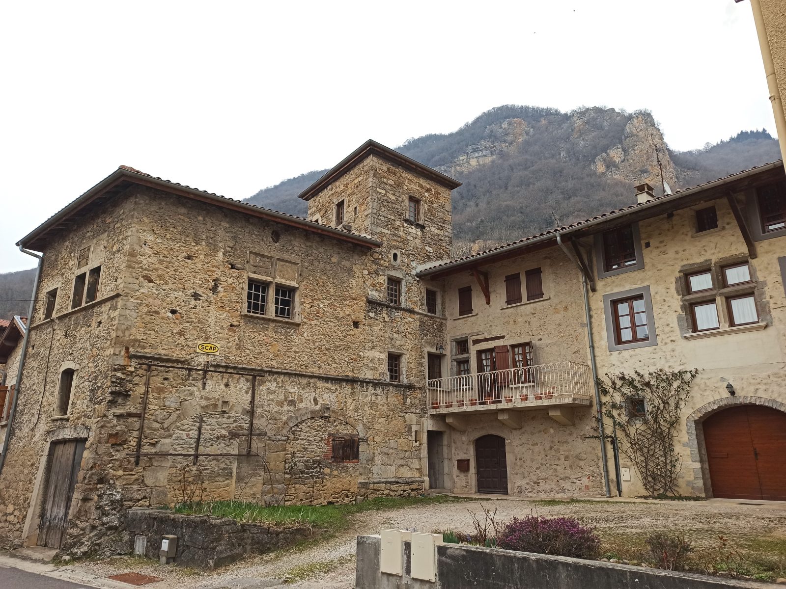
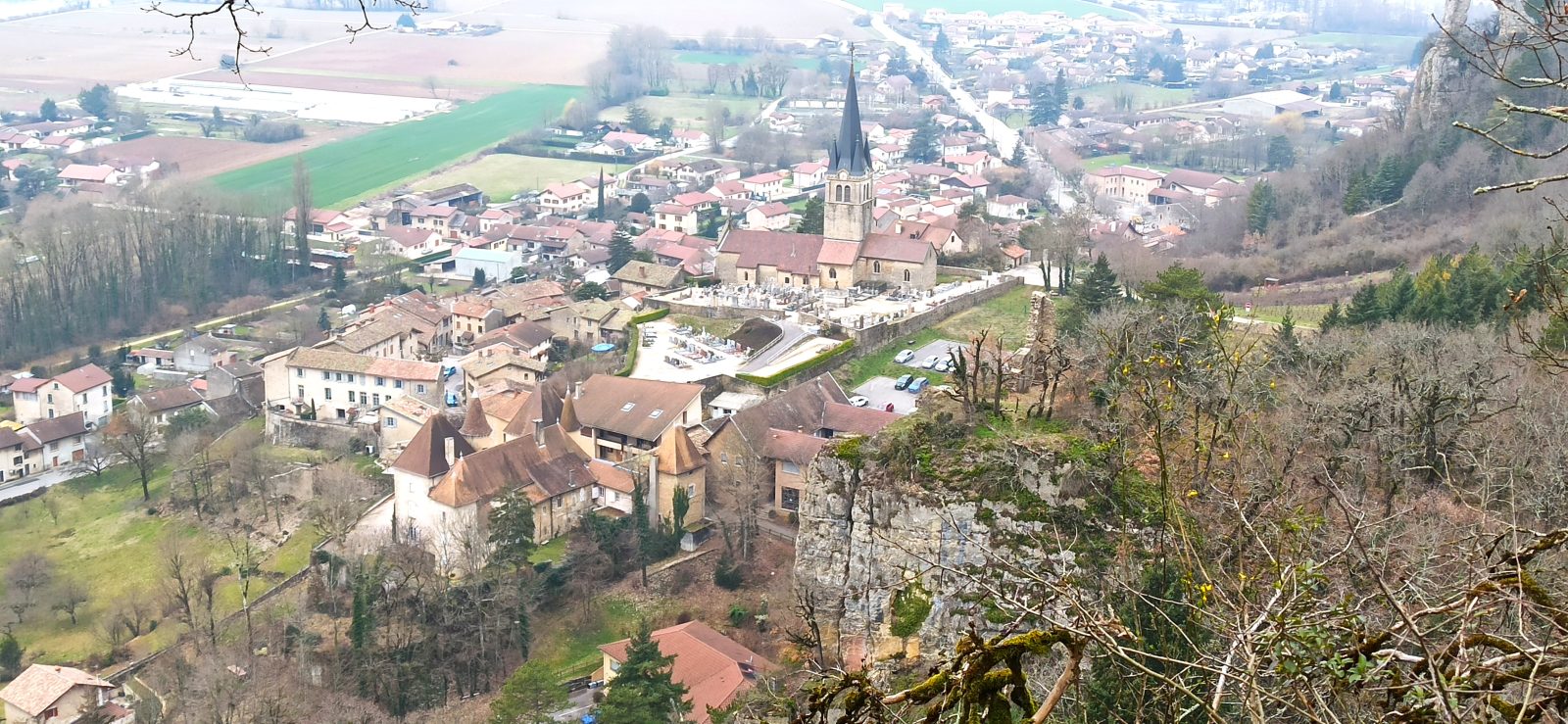
You arrive above the church along the ruins of the Château de Cuchet (XNUMXth century), follow the markings and cross the village by climbing up the church (you go along the cemetery, on the right facing the gate, public WCs open from spring to fall).
We pass along the church then in front of the house of the fresco of St Christopher (XNUMXth century)
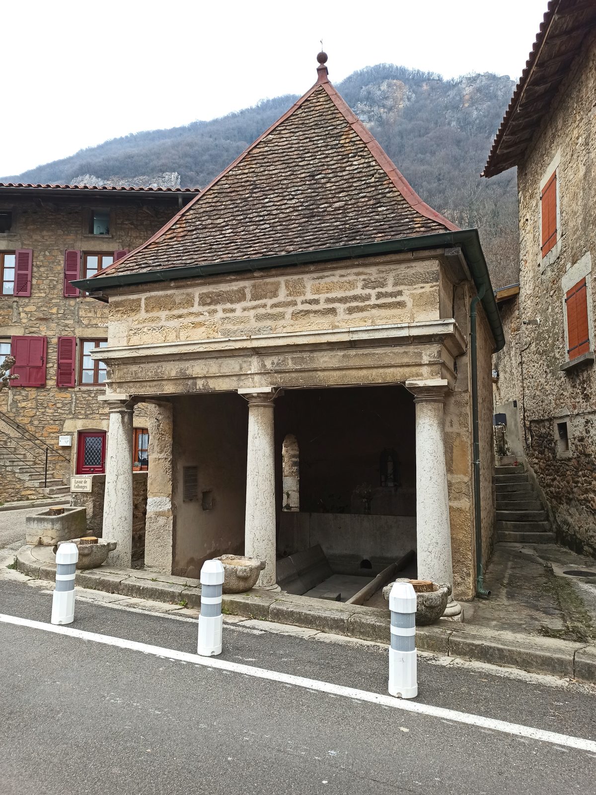
At the bakery/town hall, turn right to the Collonges washhouse (explanatory plaque for this beautiful historic monument).
At the washhouse, turn right on rue de Pallières - follow the signs to the route de la Chartreuse D60b
Turn left along the road for 600m (be careful passing vehicles but wide lane)
Turn right onto the greenway (cycle path on the right)
Follow her to the end
Then turn left onto Chemin des Roches (follow the bike signage on the ground for 200m) to Grande rue de Bulliez, to the right, to the starting point (600m).