From Perouges to Bugey
Hiking: Les Charmilles
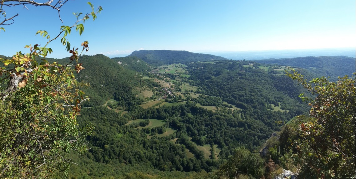
Among the paths of Bugey, this hike is the one that touches the peaks the most. At about 800 m altitude, the paths cross the charming Charmilles plateau. Discover an authentic Bugey!
From Perouges to Bugey
Among the paths of Bugey, this hike is the one that touches the peaks the most. At about 800 m altitude, the paths cross the charming Charmilles plateau. Discover an authentic Bugey!
At the church, head west. At the first crossroads (cemetery), turn right, then 200 m further, right again. Follow the stony path that climbs towards the departmental road.
Cross this road and take the path opposite. Walk it for a few hundred meters. We arrive again on the road, take it towards Ordonnaz for 200 m. Then, take a gravel path that heads off to the right. After 200 m, leave it to take a steep path on the right.
Arrived at a crossroads where you notice two large beetles at the edge of a meadow, continue by taking the stony path on the left. After 1 km you come out into the plain of Chanaux. At the crossroads with a new path (which goes towards Ordonnaz), turn right towards Innimond (South-East) for 1,2 km. We then find the forest path that crosses the Charmilles plateau.
At a crossroads of several paths, take the one that goes left from a spruce forest then immediately left again.
After 300 m, take a path also to the left of a spruce forest. This path leads to a path that leads back to Lompnas.
Before attacking the descent, don't miss a round trip leading to a superb view of the Grouin and Marchamp (typical buggery landscape but be careful, cliff).
Do not panic ! Here are all our sheltered activities.
To bring back a souvenir or something to treat yourself, stock up on local products from Pérouges in Bugey.

Village of Lompnas

Stroll with donkeys: the “walks of Rosalie and Cie”:

Seillonnaz-Crept climbing site

Village of Seillonnaz

Kids/Teens Discovery Climbing with Vertical Sensation

Cliff climbing (beginner) – with Vertical Balance

Village of Marchamp

Adventure caving – Taupe canyon

Arodin Canyon

The herbalist, nature and health workshop

Bar – Restaurant – Bakery “Chez Robert”

Bonnard House

House Froquet

Fantasy

Cave C'gentlemen

Guiffray House

Cave Grivet

The Chassard Farm

Flash Audio Tour: “A Story of Innimond: Sully and the King”

The secrets of the Pernaz river

Audio guided tour: the underside of Briord, a journey to the Gallo-Roman era

Festival En Grangeons la Musique