From Perouges to Bugey

The ridge circuit by Innimond (short variant)

Emblematic route of the Monts du Bugey in a simplified but equally spectacular version. The ridges offer exceptional panoramas of the Alps and even, if you are lucky, Mont-Blanc! Mount Pela is the highest point of this version.

Distance : 9 km
Duration : 3h
Level : Moderate
Elevation : 268 D +
Walking
The ridge circuit by Innimond (short variant)
Distance : 9 km
Duration : 3h
Level : Moderate
Elevation : 268 D +
Walking
Departure: Innimond
Loop
Stones, Earth, Not suitable for pushchairs
Pet Friendly
Descent in pebbles between Pela and Petit Perthuis (sticks strongly recommended) Descent by GR59 under the very eroded Croix du Rocher. Prefer to take the sporting route and find the GR further on. The belvedere of the Cross is equipped and secure. Do not approach the cliffs. Stony and wet paths at several points along the route. Sticks recommended.
Download the circuit: GPX Roadmap

From the charming village of Innimond, an uphill hiking trail leads to the highest point of Mount Pela. The rest of the pedestrian route follows the ridges between the Col du Perthuis and Ordonnaz, along the Tantanet. A clear passage, with a view of Bugey, gradually letting the Alps appear in the distance. The chef's surprise comes on the descent to the Col du Petit Perthuis. Facing the paragliding decor, Mont-Blanc takes shape for the lucky ones, on beautiful clear days but not too hot.

An orientation table teaches curious hikers more about the surrounding peaks. Following the old sports route, the hike ends at the Innimond cross, offering a 360°C panorama of the Bugey mountains, its champion the Grand Colombier in the distance, and a glimpse of the Ambléon lake (not authorized bathing). The final descent is to be followed with caution until the return to the village.

Your itinerary

1

Innimond at Grand Perthuis:

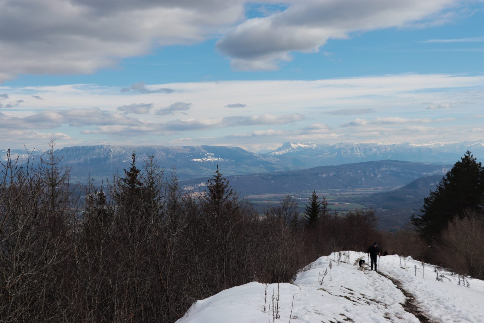
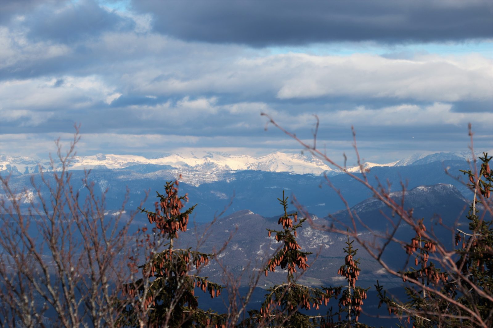
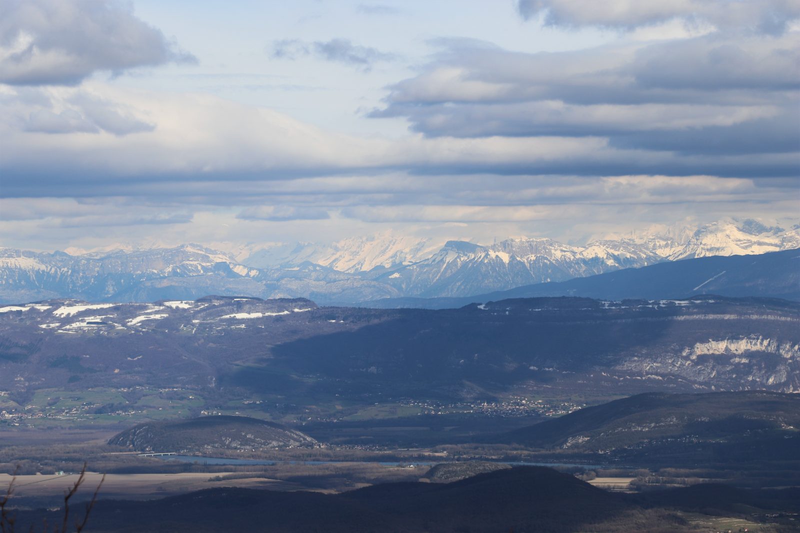
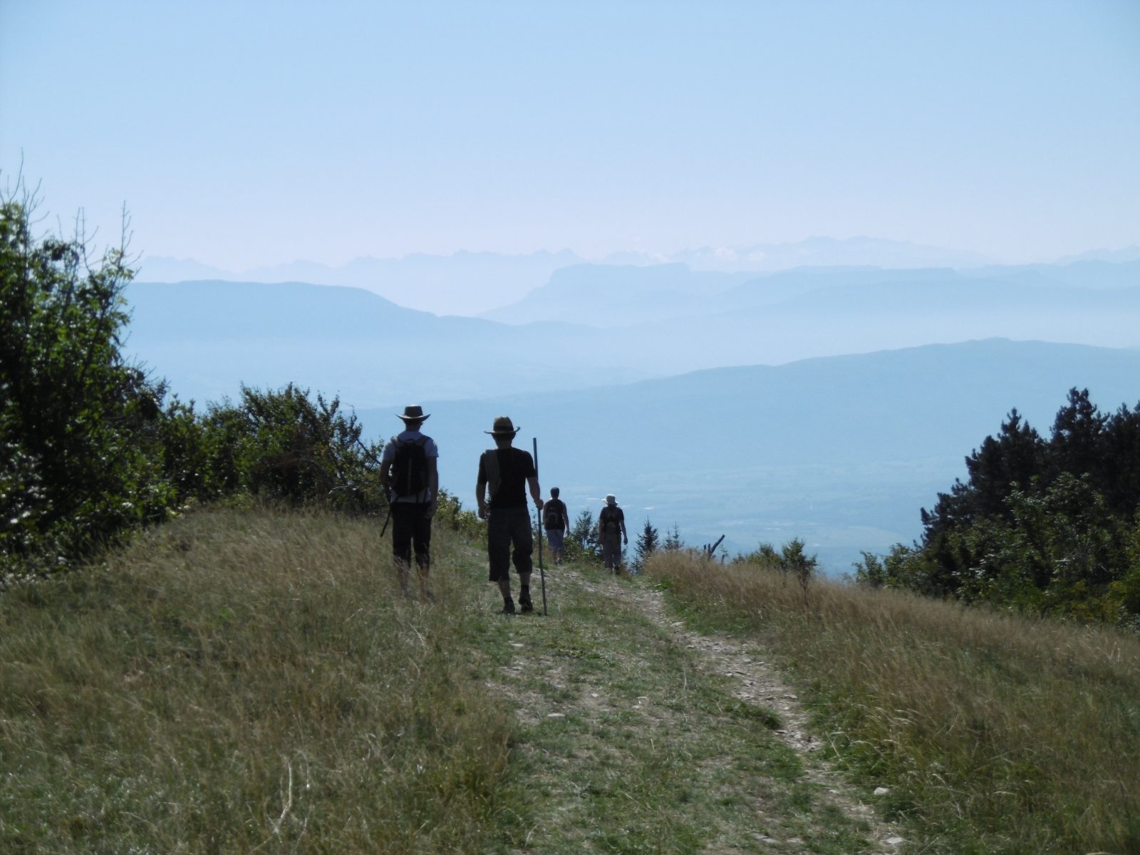
Park in the car park in the village of Innimond next to the wash house and the fire station, towards the orientation table. For the start of the hiking circuit: from the car park, go back to the village by the street on the right (30m) then turn right, pass in front of the cavers' house 50 m away and continue straight on the road towards Ordonnaz ( D94A). On leaving the village take the path to the right (cross on the hill), climb 600 m. Take the grassier path on the left which and leave the path which slopes to the right towards Crozet. Take the path to the right which leads (after 1700m) to the Col du Grand Pertuis (1096m). [If you want to go up to Mollard de Don, follow the GR59 markings in red and white].
2

Grand Perthuis - Petit Perthuis:

Turn right and follow the path (GR®59) which climbs very steeply for about fifty meters and then becomes gentler. This trail is often wet and slippery, poles will be helpful. Continue on the GR® by the ridges. After 1400m, go to the highest point of Mont Pela (1152m). Continue down slightly, pass next to a telecommunications relay. The path begins to descend a little more then the slope becomes even more accentuated to arrive at the Col du Petit Pertuis (1031 m). (Be careful in this stony part which also requires sticks).
3

Petit Perthuis - Cross of the Rock

From the pass, continue straight on the GR® which continues to descend, pass next to the hang glider take-off area. Arrived at the bottom of this descent, continue and go up slightly always on the GR®59. !! Do not be tempted to approach the cliff, a belvedere is set up and secured a little before arriving at the Croix de la Roche. After the belvedere, leave the GR® to reach the cross. NB Not recommended to go down to Innimond by the GR® which is very eroded under the cross.
4

Cross of the Rock - Innimond:

From the cross, go up 20 m to the north and find a clearly visible path which immediately splits into two. Turn left and cross the sports course (rondino). After 150m, a path heads off to the left. Take this path which goes down in the wood and joins after 500m the GR®59 immediately at the exit of the wood. Go to the right and follow this GR® for 1200 m to arrive at the starting point.

Learn more

Advice from the Office

If by chance you are hiking on a clear day, without humidity and not too sunny, you will surely have the chance to photograph Mont-Blanc, which points its white head in the distance on the horizon.

In winter, snow is often present. We think of snowshoes!

Tips for photographers

If by chance you are hiking on a clear day, without humidity and not too sunny, you will surely have the chance to photograph Mont-Blanc, which points its white head in the distance on the horizon.

In case of rain

Do not panic ! Here are all our sheltered activities.

On the way back

To bring back a souvenir or something to treat yourself, stock up on local products from Pérouges in Bugey.

Nearby

What to do

Send

Accommodation

Send

Restaurants

Send

You may also like...

La randonnée des crêtes en raquettes

Hiking the ridges on snowshoes

L’oeil de la tourbière – ENS de l’Ain

The eye of the bog – ENS de l'Ain

Point de vue : l’œil de la tourbière de Cerin (ENS)

Point of view: the eye of the bog of Cerin (ENS)

Randonnée pédestre avec Lézard des bois

Hike with Wood Lizard

Moto : entre Rhône et Bugey

Motorcycle: between Rhône and Bugey

Village d’Innimond

Innimond Village

La carrière de Cerin, ENS de l’Ain

The career of Cerin, ENS de l'Ain

Sentier de la carrière de Cerin (ENS de l’Ain)

Cerin quarry trail (ENS de l'Ain)

Musée paléoécologique de Cerin

Paleoecological Museum of Cerin

Gaec Les Chamoisées

Gaec Les Chamoises

Bar – Restaurant – Boulangerie « Chez Robert »

Bar – Restaurant – Bakery “Chez Robert”

Au Millieu des fruits du Bugey

In the middle of the fruits of Bugey

L’atelier herbaliste, nature et santé

The herbalist, nature and health workshop

Maison Martin-Cocher

Martin-Cocher House

L’auberge de Lhuis  – restaurant afterworks live café

Auberge de Lhuis – restaurant afterworks live café

La chèvrerie du Naray

Naray goat farm

Domaine Trichon

Domaine Trichon

Visite audio flash: « Une histoire d’Innimond: Sully et le Roi »

Flash Audio Tour: “A Story of Innimond: Sully and the King”

Marché alimentaire de Lhuis

Lhuis food market

Trail SO Bugey – 7e édition

Trail SO Bugey – 7th edition

Visite contée sonore de Lhuis

Audio storytelling tour of Lhuis

Labyrinthe végétal à la ferme du Naray

Vegetal labyrinth at the Naray farm